Stitched in seconds
A mid-size block comes together in about fifteen seconds on an ordinary laptop, so the map is usable the same day the drone lands.
Victech product · Windows desktop tool
Oil palm estates fly their own drones but rarely have anywhere to put the photos. VicTerra stitches a flight into one orthophoto in seconds, then prints it under the linework of the GeoPDF task sheet the office already issues — same boundaries, same grid, this month's ground beneath them. No GIS staff, no cloud, no new system to learn.
Built for estate offices that could never justify the price of a full photogrammetry suite.
A mid-size block comes together in about fifteen seconds on an ordinary laptop, so the map is usable the same day the drone lands.
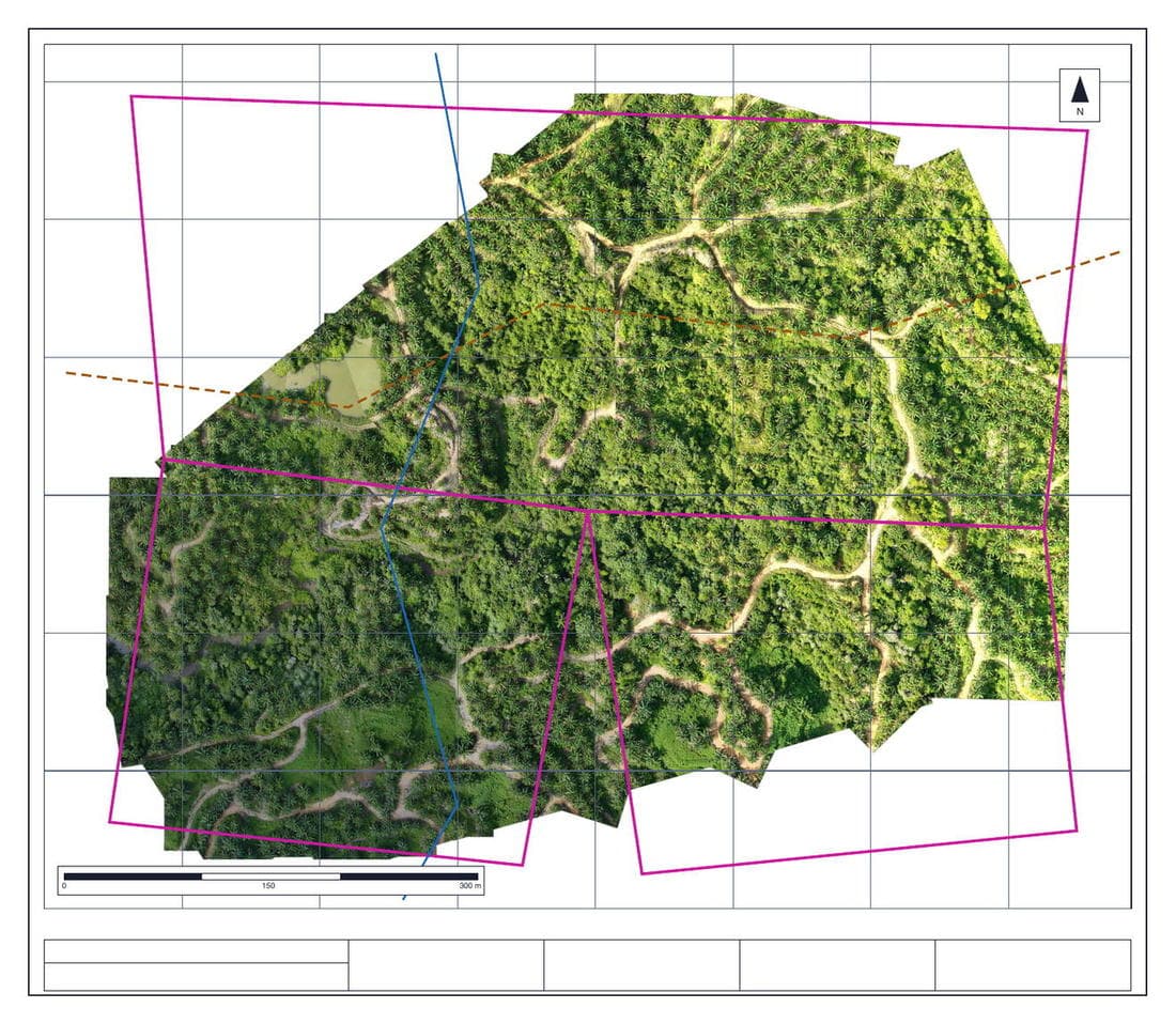
The imagery goes under the boundaries, grid and scale bar of the GeoPDF sheet you already use. Ground the flight missed stays printed map.
The whole job runs on the estate's own machine. Photos are never uploaded and never pass through us.
On a curving estate road, click the two ends and add a point or two where the line drifts; it leans onto the road surface. It is a beta and off by default, and it does not warn you when it snaps wrong, so check by eye. One undo removes it.
What comes out is the same PDF the supervisor already carries — only now the block boundaries sit over live imagery instead of blank paper. Open it, print it, or load it into VicMap on a phone.
Reference imagery, accurate to roughly ±3 metres. Not for survey, boundaries, area or contractual use.
The full product site shows real output from real flights and how the merge works. Or send us a set of flight photos and one task sheet on Telegram and we'll run it for you.